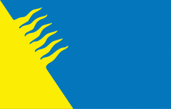
Kohtla-Järve (Kohtla-Järve linn)
 |
 |
Kohtla-Järve is unusual among the municipalities of Estonia due to its territory being made of several discontiguous parts. The two main parts, Järve (Kohtla-Järve proper) and Ahtme, both with populations around 20,000, are located about 10 km apart. Several other settlements in north-eastern Ida-Viru county, connected to oil shale mining, are administered as districts of Kohtla-Järve. During most of the period of the Soviet occupation, the town of Jõhvi was also incorporated into Kohtla-Järve.
The history of Kohtla-Järve is closely tied to the history of extraction of oil shale – the main mineral of Estonia.
There is evidence that a number of settlements existed on the territory of modern Kohtla-Järve since the High Middle Ages. In the Danish Land Book, Järve and Kukruse villages were first mentioned in 1241 by the names Jeruius and Kukarus respectively, and Sompa village in 1420 by the name Soenpe. Its German name was Kochtel-Türpsal.
Local residents were aware of oil shale's flammable capability in ancient times, but its industrial extraction in Estonia began only in the 20th century. In 1916, researches showed that oil shale could be used both as fuel and as a raw material for chemical industry, and mining started near Järve village. In 1919, the Estonian State Oil Shale Industrial Corporation was formed and extraction by shaft and open-pit mining was extended. Settlements for workers began to appear adjacent to the mines. In 1924 the oil shale processing factory was built near Kohtla railway station, and the nearby settlement, named Kohtla-Järve, started to grow.
During World War II the value of the Estonian oil shale deposit grew. The Germans, who occupied Estonia in 1941–1944, considered it as an important source of fuel. However, they failed to begin full-scale extraction.
After the war, the next occupier of Estonia, the Soviet Union, required constantly increasing quantities of oil shale for its industries and extraction greatly expanded. Kohtla-Järve, as the main settlement in the mining area, received city status on 15 June 1946. Since that time, during the next twenty years, there was a process of administrative amalgamation of neighboring settlements within the limits of Kohtla-Järve. Kohtla and Kukruse were added to the city in 1949; Jõhvi, Ahtme and Sompa in 1960. The town of Kiviõli and the boroughs of Oru, Püssi and Viivikonna were subordinated to the city in 1964. Thus, Kohtla-Järve greatly expanded, becoming a city with a unique layout, as its parts remained scattered among woods, agricultural areas and oil shale mines. Total population of the city increased mainly by workers sent from different parts of Soviet Union, reaching (with subordinated settlements) 90,000 in 1980.
After the end of the Soviet Union occupation, Estonia regained independence in August 1991, and thereafter the number of city districts decreased, as Jõhvi, Kiviõli and Püssi became officially separate towns. The volume of oil shale extraction and processing decreased dramatically during the 1990s, and many Kohtla-Järve citizens moved to Tallinn or Russia, due to high unemployment in Ida-Viru County.
Map - Kohtla-Järve (Kohtla-Järve linn)
Map


Country - Estonia
 |
 |
| Flag of Estonia | |
The land of what is now modern Estonia has been inhabited by Homo sapiens since at least 9,000 BC. The medieval indigenous population of Estonia was one of the last pagan civilisations in Europe to adopt Christianity following the Papal-sanctioned Livonian Crusade in the 13th century. After centuries of successive rule by the Teutonic Order, Denmark, Sweden, and the Russian Empire, a distinct Estonian national identity began to emerge in the mid-19th century. This culminated in the 24 February 1918 Estonian Declaration of Independence from the then warring Russian and German Empires. Democratic throughout most of the interwar period, Estonia declared neutrality at the outbreak of World War II, but the country was repeatedly contested, invaded and occupied, first by the Soviet Union in 1940, then by Nazi Germany in 1941, and was ultimately reoccupied in 1944 by, and annexed into, the USSR as an administrative subunit (Estonian SSR). Throughout the 1944–1991 Soviet occupation, Estonia's de jure state continuity was preserved by diplomatic representatives and the government-in-exile. Following the bloodless Estonian "Singing Revolution" of 1988–1990, the nation's de facto independence from the Soviet Union was restored on 20 August 1991.
Currency / Language
| ISO | Currency | Symbol | Significant figures |
|---|---|---|---|
| EUR | Euro | € | 2 |
| ISO | Language |
|---|---|
| ET | Estonian language |
| RU | Russian language |